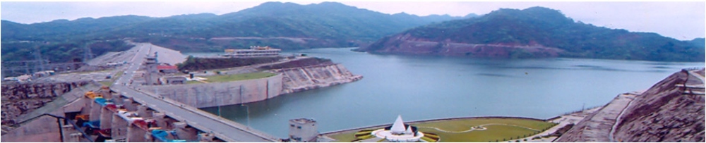
Water Resources Organisation
Water Resources Organization is primarily entrusted with Research and Development activities relating to ground water, surface water and various watersheds in the kandi areas. It came into existence in the year 1970 when a directorate was set up for carrying out explorations for Water Resources. Various activities being undertaken are:
Ground Water related activities
- Ground Water monitoring
- Collection of rainfall data
- Collection of ground water & soil quality data
- Preparation of various maps such as ground water depth maps, long term rise and fall of water level fluctuation maps
- Carrying out hydrological, hydro-geological, hydro-chemical, geophysical, mathematical, statistical, agronomical, remote sensing and other studies.
- Deep ground water investigations to identify aquifer parameters
- Dynamic Ground Water Estimation depicting the stage of development of ground water resources. Click Here
- Maintaining data base for ground water.
- Framing of policy matters like ground water legislations and State Water Policy
- Blocks Notified by Central Ground Water Authority in Punjab View Map View List
All these activities are being carried through Water Resources and Environment Directorate located at Chandigarh.
Surface Water related activities.
- Up gradation of hydro meteorological network in Punjab State
- Up gradation of discharge observation sites
- Maintaining data base for surface water
- Planning and Design Directorate located at Chandigarh undertakes all these activities.
Development of watersheds in kandi areas
- Topographical, hydro geological, preliminary geographical & geotechnical investigations in the field
- Collection of data of flood related damages, soil fertility, crops suitability and economic activities of effected people
- Preparation of feasibility reports for development of various watersheds in kandi areas falling in districts of Gurdaspur, Hoshiarpur, Nawanshehr and Ropar.
Planning and Design Directorate located at Chandigarh undertakes all these activities.
Objectives
Water is a natural resource, a basic human need, a scarce commodity. The main objective of Water Resources Organization is to carry out the ground water and surface water studies for formulations of various schemes and policy matters for the judicious use of Water Resources in Punjab State.
ORGANISATIONAL SET UP
Historical
Since 1970, Water Resources and Environment Directorate is regularly collecting rainfall data, monitoring the ground water levels, preparing various maps and doing Dynamic Ground Water Estimation. Ground water quality studies were carried out in south western Punjab by installing 638 nos. P-tubes under the world Bank Aided “Punjab Irrigation and drainage Project Phase-2” Directorate of Planning & Design Studies has so far identified 36 (out of 50) watersheds and completed feasibility studies of 30 dam sites. SEE LIST.
Projects
- Ground Water Investigation & Integrated Utilization of Water Resources in Punjab State
- Artificial Recharge to Augment the declining Ground Water Resources in the Punjab State
- World Bank Aided Hydrology Project Phase-2
Tenders
Information regarding tenders is given on the web site of Punjab Irrigation Department . and also in print media as per departmental/World Bank guidelines.
List of Watersheds and Dam sites where feasibility studies have been carried out/yet to be carried out
|
Sr.no.
|
Name of watershed
|
Name of dam site
|
|
1
|
Maili |
Maili |
|
2
|
Janauri |
Janauri |
|
3
|
Chohal |
Chohal |
|
4
|
Tibba Nangal |
Tibba Nangal |
|
5
|
Mehngarwal |
Mehngarwal |
|
6
|
Siswan |
Siswan |
|
7
|
Saleran |
Saleran |
|
8
|
Budki |
Budki |
|
9
|
Lalwan |
Lalwan |
|
10
|
|
|
|
11
|
Jainti Devi ki
Rao |
Jainti Devi ki
Rao |
|
12
|
Sugh Rao |
Sugh Rao |
|
13
|
Dasua Langarpur
(group of choes) |
Ramtatwali, |
|
14
|
Arniala |
Arniala |
|
15
|
Mohan majra |
Mohan majra |
|
16
|
Balachor |
Balachor |
|
17
|
Patiari |
Patiari |
|
18
|
Dada, Manjhi,
|
Dada, Manjhi,
|
|
19
|
Sukkar Suha |
Sukkar Suha |
|
20
|
Rajni Devi |
Rajni Devi |
|
21
|
Chak Sadhu |
Chak Sadhu |
|
22
|
Sialba Majri |
Sialba Majri |
|
23
|
Ratewal |
Takarla 1, Takarla
11 |
|
24
|
Chakki Khad |
Dugli, Chanalon(Proposal
dropped on pre. Investigation) |
|
25
|
Kharkan Nrur Choe |
Site yet to be
selected |
|
26
|
Baruhi Choe |
-------- |
|
27
|
Patiari |
-------- |
|
28
|
Jaijon Khad |
-------- |
|
29
|
Jhand ji ki khad |
-------- |
|
30
|
Balewal Khad |
-------- |
|
31
|
Barani Khad
|
-------- |
|
32
|
Nurpur khad |
-------- |
|
33
|
Kartarpur khad |
-------- |
|
34
|
Sabaur khad |
-------- |
|
35
|
Bhanwar khad
|
-------- |
|
|
Darang khad |
--------- |
Ground Water Investigation & Integrated Utilization of Water Resources in Punjab state
Above project was started in the year 1971 and has now been revised to an estimated cost of Rs. 98.63 Crores and to be completed by 3/2015. However, the works being of continuous nature and research & development type, it is likely to continue beyond 3/2015 too. The various works carried out under this project are:Installation of exploratory bores to determine sub soil litho logy, thickness and nature of aquifer and its hydraulic characteristics in the entire state of Punjab. Out of 62 E-bores planned to be installed, 32 E-bores have so far been installed.
Installation of shallow piezometer tubes (upto35.5m depth) to monitor the ground water levels and to ascertain quality of ground water in the state.
- Installations of deep P-tubes in some of the blocks where there is confined nature of aquifer under different piezometer heads, is carried out to ascertain the piezometric head of the deep aquifer.
- Testing of water samples in the hydro chemical laboratory to determine its quality for agriculture use, the extent of salinity, residual sodium carbonate, its suitability for irrigation and its effect on irrigation crops.
- Collection of rainfall data from various rain gauge stations/ meteorological stations of different departments such as Irrigation Department, Director /land Records, Indian Meteorological Department etc.
- Compilation of data for analyzing the annual as well as monsoon rainfall and preparation of Isohytal maps
- Determination of behaviour of block-wise and district-wise annual /monsoon/average rainfall with reference to IMD norms to assess the excess and deficit values.
- Preparations of maps and technical reports relating to hydrological, water quality, hydro geological and hydro meteorological for future planning.
- Estimation of replenish able ground water resources at block level, assessment of water logged areas, estimation of static ground water resources, the assessment of annual/long term rise/fall in water table, the assessment of ground water quality with depth, the assessment of trends at block levels.
- Formulation of schemes for proper planning, development and utilization of water resources. The project is being implemented by Water Resources & Environment Directorate, Punjab.
World Bank Aided Hydrology Project Phase II.
The World Bank Aided Hydrology Project Phase-II is being implemented in 13 States of the Country, including Punjab and 9 Central Agencies simultaneously, through the MoWR, GOI. This Project is to improve institutional and organizational arrangements, technical capabilities and physical facilities available for measurement, validation, collation, analysis, transfer and dissemination of hydrological, hydro-meteorological and water quality data and in the development of comprehensive, easily accessed and user friendly data bases covering all important aspects of hydrological cycle for long term planning and development of water resources. This will help in creating proper Hydrological Information System (HIS), continuous data collection, its validation and computerization in standard format. The Project is to be implemented over a period of six years. Year 2006-07 was the first year of the Project and it has been made effective from 5.4.2006 by World Bank.
The Base Cost of the Punjab Component of HP-II is Rs. 40.95 Crores. (out of Rs. 525.59 Crores Project Base Cost). The World Bank has approved a contingent cost of the HP-II Project as Rs. 631.83 Crores with Punjab Component as Rs. 49.78 Crores.
With the completion of this Project, the following benefits will be achieved:-
- Improvement in infrastructure for HIS Data Collection.matic recording of river gauge, rainfall, ground water level, quality data.
- Computerization of validated data and its free access to general public and Water Resources Project Planners.
- Storage of validated data for all hydrological parameters in a single building.
- It will help in proper planning of all Water Resources Projects.
- Enhancing technical capabilities of data collection staff by proper training.
- Improvement in communication facilities which will further help in flood alarming system for safety of people.
- The project has two components . Ground water component is being executed by Water Resources & Environment Dte. , Punjab, Chandigarh and Surface Water Component is being executed by Planning & Design Studies Dte, Punjab Chandigarh . Director, Water Resources & Environment Dte. , Punjab, Chandigarh is the nodal officer for the project.
- Artificial Recharge to Augment the declining Ground Water Resources in the Punjab State
A project for "Artificial Recharge to Augment the declining Ground Water Resources in the Punjab State" amounting to Rs. 31.90 Crores was submitted to NABARD, which has been partially approved for Rs. 9.62 Crores under RIDF-XIII for observing its impact initially.